Nasa has mapped out mercury s entire surface

NASA has Mapped Out Mercury’s Entire Surface

NASA, the National Aeronautics and Space Administration, continues to unravel the mysteries of the solar system with its groundbreaking space exploration missions. One such mission involved the meticulous mapping of Mercury’s entire surface. This extraordinary endeavor has provided scientists with a wealth of information about the closest planet to the Sun.
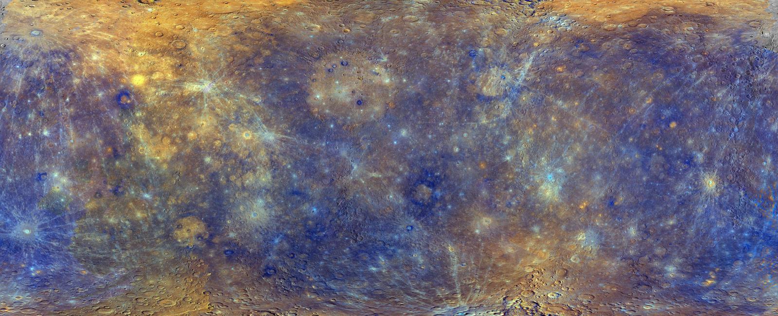
The first image we can see is a colorful map of Mercury, revealing the planet’s rugged surface in unprecedented detail. This high-resolution map offers a close-up view of Mercury’s terrain, showcasing its countless craters, mountains, and vast plains.
Mercury, often referred to as Earth’s gray twin due to its similar solid rocky composition, has long perplexed scientists. With its proximity to the Sun and lack of substantial atmosphere, it experiences extreme temperature changes. During its daytime, surface temperatures can soar up to a scorching 800 degrees Fahrenheit (430 degrees Celsius), while at night, they plummet to a freezing -290 degrees Fahrenheit (-180 degrees Celsius).
Despite the challenging conditions, NASA’s Messenger spacecraft carried out a meticulous survey of Mercury’s entire surface. Messenger, short for Mercury Surface, Space Environment, Geochemistry, and Ranging, orbited the planet for four years, from 2011 to 2015, capturing detailed images and collecting valuable scientific data.
Through its observations, NASA’s Messenger spacecraft unveiled numerous fascinating features of this enigmatic planet. The mapping revealed vast impact craters created by ancient collisions with asteroids and comets. One such notable feature is the Caloris Basin, an immense impact crater approximately 960 miles (1,550 kilometers) in diameter. These craters provide scientists with insights into Mercury’s geological history and the forces that have shaped its surface.
The mapping also brought to light Mercury’s long and winding cliffs, called scarps. These scarps, which can extend for hundreds of miles, exposed the planet’s tectonic activity, indicating that Mercury’s interior is still cooling and contracting. This revelation challenges previous assumptions about the planet’s geological stability and provides valuable information about its formation and evolution.
In addition to unveiling these geological features, NASA’s mapping of Mercury’s surface has allowed scientists to explore its rich mineral composition. The planet’s surface is primarily composed of silicate rocks, with significant amounts of iron, sulfur, and other elements. By analyzing the data collected during the mapping mission, researchers have gained valuable insights into Mercury’s geology and its potential similarities to Earth’s early history.

NASA’s mapping mission of Mercury’s entire surface has paved the way for a deeper understanding of this intriguing planet. With its rugged terrain, ancient impact craters, and vast lava plains, Mercury now stands as a testament to the planet’s turbulent geological history. By further studying this data-rich map, scientists can continue to unlock the secrets of Mercury and shed light on the formation and evolution of not just our neighboring planet, but also our own planet Earth.
(Source: nineplanets.org)
Related Posts
Quick Links
Legal Stuff

